Visualize large GeoJSONs in Databricks notebooks
See also Visualize large GeoJSONs in Google Colab.
You can use Folium, Kepler.gl or Lonboard on Databricks, but they all run into the same issue if your dataset is too large: the widgets won't load and you'd have to save the output as an HTML file. This you can then download and open locally (if the file is too large to download from Workspace files, you'd need to save it to Unity Catalog volumes and download from there).
# Folium
map.save("folium.html")

# Kepler.gl
map.save_to_html(file_name="kepler.html")

# lonboard
map.to_html("lonboard.html")
Pydeck
Pydeck, however, is the one example that is able to visualize ~100+ MB datasets:
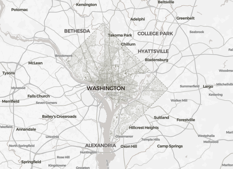
# Data via https://catalog.data.gov/dataset/building-footprints-d97ff
LARGE_GEOJSON_URL = "https://opendata.dc.gov/api/download/v1/items/a657b34942564aa8b06f293cb0934cbd/geojson?layers=1"
import geopandas as gpd
gdf = gpd.read_file(LARGE_GEOJSON_URL)
bounds = dict(
zip(
["min_lon", "min_lat", "max_lon", "max_lat"],
gdf.total_bounds,
)
)%pip install pydeck --quietimport pydeck as pdk
bbox_corners = [
[bounds["min_lon"], bounds["min_lat"]],
[bounds["max_lon"], bounds["max_lat"]],
]
view_state = pdk.data_utils.compute_view(bbox_corners)
geojson_layer = pdk.Layer(
"GeoJsonLayer",
LARGE_GEOJSON_URL,
pickable=True,
stroked=True,
autoHighlight=True,
get_fill_color=[200, 200, 255, 200],
extruded=True,
elevation_scale=0.005,
)
pdk.Deck(layers=[geojson_layer], initial_view_state=view_state)